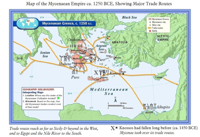
map-of-mycenaean-greece-ca-1250-bce Published December 19, 2019 at 640 × 438 in NEWSFLASH! UC Archaeologists Find Gold-Lined Tombs of Mycenaean Era in Pylos, Greece ← Previous Next → Map of Mycenaean Greece, ca. 1250 BCE, showing trade routes. Source: linearbknossosmycenae.com url: https://linearbknossosmycenae.com/2014/09/28/two-maps-of-mycenaean-greece-the-second-illustrating-the-mycenaean-empires-extensive-trade-routes/ Share this: Share on Facebook (Opens in new window) Facebook Share on X (Opens in new window) X Share on LinkedIn (Opens in new window) LinkedIn Share on Pinterest (Opens in new window) Pinterest Share on Tumblr (Opens in new window) Tumblr Share on Instagram (Opens in new window) Instagram Share on Reddit (Opens in new window) Reddit Like Loading...

